
UAS / DRONE GEOSPATIAL DATA EXPERTS
Every Flight.
A Clearer Picture.
Turn drone collections into useful maps, analysis and shared operational awareness. Connect processing, live video, Geospatial Full Motion Video, aircraft workflows and data delivery with the teams doing the work.
Geospatial experts wanted. Join as an advisor or beta tester. Your experience helps shape Drone Scout Cloud, and advisors and beta testers receive a free 1-year account.
FREE FIELD SENTINEL APPS / iOS · Android · Windows · Mac · Linux
CAPTURE → PROCESS → UNDERSTAND
Conceptual survey illustration
01 / CAPTURE
Imagery, LiDAR & field evidence
02 / PROCESS
Maps, terrain & 3D products
03 / ANALYZE
Interpret conditions & change
04 / DISTRIBUTE
Deliver to the next workflow
05 / OPERATE
Connect teams & assets
ONE CONNECTED WORKFLOW
The flight is just the beginning.
Bring the collection, the analysis and the people who use it into a connected product family.
Video streaming & review
07
Connect live sources, arrange multi-view layouts and save useful recorded-video reviews.
Geospatial Full Motion Video
08
Bring KLV, VMTI, map overlays, geographic search and review packages into the workflow.
MAVLink integration
09
Connect aircraft telemetry, TAK awareness and qualified mission or payload workflows.
AIRCRAFT WORKFLOWS & PUBLIC SAFETY
Connect the collection to the operation.
DJI WORKFLOWS & SDK SCOPE
Mission files.
Media. Telemetry.
Use WPML/KMZ mission handoff, supported DJI video-to-MISB conversion and flight-log review. Explore the implemented workflows and the current scope of DJI SDK integration.
PUBLIC SAFETY · DRONE AS FIRST RESPONDER
Coordinate around
a shared picture.
Evaluate DFR coordination and monitoring with maps, aerial video, aircraft observations and participating field teams. Define the agency and provider qualification needed for a live rollout.
FROM RAW DATA TO SPATIAL CONTEXT
One site.
Many ways to understand it.
An orthomosaic gives you the overview. A surface adds elevation. A thermal image reveals a different condition. Field observations explain what the team found on the ground.
- Imagery and point-cloud processing
- Terrain, thermal and analytical workflows
- Maps, models and practical deliverables
A collection with a purpose
Start with the decision. Then choose the sensors, products and quality checks that can support it.
A result with context
Keep source information, spatial reference and intended use close to the output.
A handoff that works
Prepare the formats and delivery method for the people who will use the result.
FREE FIELD SENTINEL COMPANION APPS
The field is part of the platform.
Put maps, structured forms and team awareness on the devices your people carry. Connect aerial products with observations from the ground.
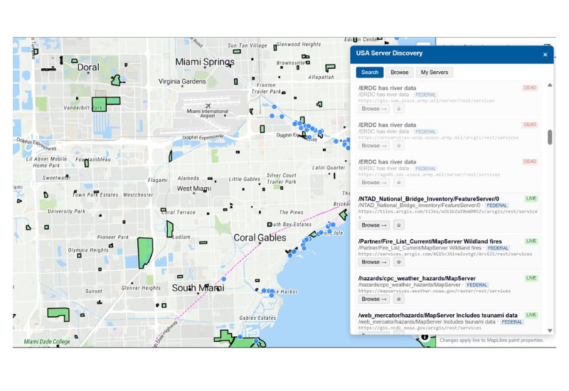
Field Sentinel desktop interface · official product image
Forms & field evidence
Capture structured observations with location and media.
TAK & asset tracking
Keep authorized people, vehicles and assets in the operational picture.
Remote ID & ADS-B
Bring supported broadcast receivers and aircraft feeds into map context.
BUILT AROUND THE JOB
Start with the outcome you need.
Survey & mapping
Create useful geospatial deliverables.
Construction
Connect surfaces and site observations.
Infrastructure
Bring inspection evidence into context.
Public safety
Support shared operational awareness.
EXTEND YOUR OPERATION WITH GEOINSIGHTS
For a picture that keeps moving.
Need more robust real-time data, event-driven workflows, movement analytics or additional API integrations? Add GeoInsights to extend the solution beyond the aerial collection.
CHOOSE YOUR DEPLOYMENT
SaaS or self-hosted.
Choose a hosted offering or a deployment in your own environment. Scope the live feeds, integrations and analytics around your operation.
A DEPLOYMENT THAT FITS
Connect the right tools for your operation.
Drone Scout combines a broad processing engine with an evolving private cloud workspace and Field Sentinel companions. We’ll help identify the supported capabilities for your data and environment.
QUESTIONS, ANSWERED
A few useful details.
What does Drone Scout Cloud connect?
UAS processing, geospatial analysis, video and Geospatial FMV, visualization, distribution and aircraft workflows, with Field Sentinel companions for field participation.
Which companion apps are free?
The Drone Scout offering includes free Field Sentinel companions for iOS, Android, Windows, Mac and Linux. Hosted services, enterprise editions and hardware are separate.
How do we evaluate the cloud offering?
Contact the team for a workflow discussion. The private cloud workspace is currently a pilot; production qualification and broader data profiles are still in progress.
BRING YOUR NEXT PROJECT
Let’s connect your workflow.
Start with a collection, an operational challenge or a deliverable. We’ll help map the path from capture to a useful result.
dronescoutCLOUD
From aerial collections to shared operational understanding.
By Tech Maven Geospatial
TMG Home ↗
Free companion apps
Contact the team
© 2026 Tech Maven Geospatial. Drone Scout Cloud.
Free companion apps; hosted services and enterprise editions are separate. Cloud workspace available for pilot evaluation.